
Dubai Metro Map 2025: Complete Route Guide
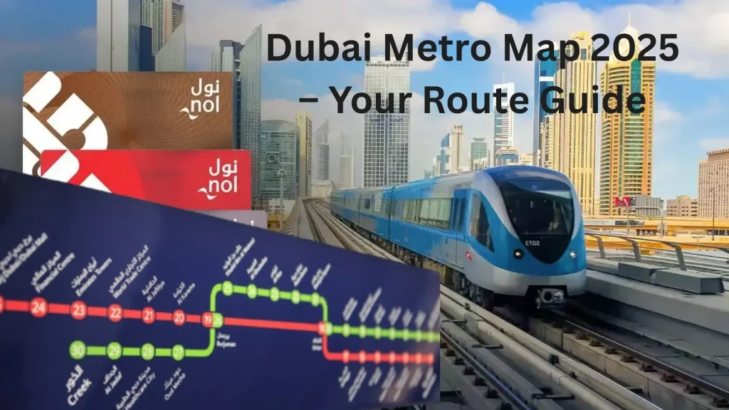
The Dubai Metro Map 2025 is the ultimate navigation tool for residents and tourists using the city’s smart transport system . With over 5 million users each month, it clearly shows Red Line and Green Line routes, stations, zones, and schedules .
Whether you’re commuting to work or exploring top attractions like Burj Khalifa , the Dubai Metro Map makes city travel easy, fast, and stress-free .
Dubai Metro map Lines: A Complete Guide
Dubai’s metro system operates on two major lines — the Red Line and Green Line — connecting important parts of the city. These lines cover busy neighborhoods , business centers , and top tourist destinations .
Fitted with air-conditioned comfort , the modern driverless trains allow passengers to travel quickly and conveniently across Dubai. Understanding both lines helps improve route planning and reduce overall travel time .
Red Line Metro in Dubai: Full Route & Station List
The Red Line stretches for 67.1 kilometers and includes 35 stations , serving as the core of Dubai’s public transport system . It starts at Centre point and extends to both Expo 2020 and UAE Exchange through a Y-junction at Jebel Ali , connecting major areas along Sheikh Zayed Road .

It serves key locations such as Dubai International Airport (Terminals 1 and 3), Downtown Dubai , Business Bay , and Dubai Marina , making it useful for both locals and international travelers.
Key Red Line Destinations:
Dubai Metro Green Line: Coverage Areas & Key Stops
The Green Line runs for 22.5 kilometers and includes 20 stations , connecting key parts of Dubai’s historic district and cultural district . It starts at Etisalat station and ends at Creek , passing through popular areas like Deira , Bur Dubai , and the traditional souks .
The line features 12 elevated stations and 8 underground stations , built with designs that reflect local heritage and culture.
Important Green Line Locations:
Dubai Metro Map Types and Navigation Guide
Dubai provides various dubai metro map formats to help passengers move through the system with ease. The schematic map gives a simple view of routes, while interactive maps deliver real-time updates and full station details.
Both types show zone information , which helps calculate fares and plan cost-effective journeys . You can find digital versions on official RTA apps and websites , making them easy to access anytime.
Key Features of Dubai Metro Map
The Dubai Metro map shows all stations on the Red Line and Green Line in a clear, simplified layout. It includes transport zones numbered 1 to 7, which are used to calculate ticket prices based on travel distance.
Station names are often based on nearby landmarks or commercial sponsors , helping travelers easily recognize their destination. The color-coded design makes it simple to tell the lines apart and find transfer points.
Why Use Dubai’s Interactive Metro Map?
Dubai metro map offers live information on train timings , delays , and station facilities . By clicking on station icons, users can view real-time arrival information and current service updates .
These digital maps are mobile-friendly and work on smartphones and tablets , helping travelers plan their routes while on the go. Features like zoom functionality and location-based services make navigation easier and more efficient.
Station Categories and Zones
| Zone | Areas Covered | Key Stations |
| Zone 1 | Central Dubai | Union, Burjuman, World Trade Centre |
| Zone 2 | Business Bay, Downtown | Burj Khalifa, Financial Centre, Business Bay |
| Zone 3 | Marina, JLT | Dubai Marina, DMCC, Mall of Emirates |
| Zone 4 | Airport, Deira | Airport Terminal 3, City Centre Deira |
| Zone 5 | Outer areas | Jebel Ali, Expo 2020 |
The Dubai Metro Map system in Dubai is divided into seven zones for fare calculation . Each zone includes several stations covering various neighborhoods and tourist spots.
Knowing the zone boundaries helps travelers estimate travel costs and pick the right ticket types . These zones are based on the city’s geographical and administrative divisions .
Metro Timings and Train Frequency in Dubai
The Dubai Metro runs seven days a week with schedules designed to meet various passenger needs . Weekday services operate from 5 AM to midnight , and on Friday , trains run until 1 AM .
Weekend schedules vary slightly, with Sunday services starting at 8 AM . These timings support both early commuters and late-night travelers with dependable public transport .
Dubai Metro Peak and Off-Peak Timings Explained
Trains run frequently during peak hours (6 AM to 8:30 AM and 5 PM to 7 PM ) — arriving every 3 minutes and 45 seconds .
During off-peak periods , trains come every 7 minutes on both lines. This train frequency helps ensure minimal waiting times and smooth passenger flow throughout the day. Peak-hour services are designed to handle higher crowds during rush periods .
Weekend and Holiday Schedules
| Day | Operating Hours | Frequency |
| Monday-Thursday | 5 AM – 12 AM | 3:45 min (peak), 7 min (off-peak) |
| Friday | 5 AM – 1 AM | 3:45 min (peak), 7 min (off-peak) |
| Saturday | 5 AM – 12 AM | 7 minutes |
| Sunday | 8 AM – 12 AM | 7 minutes |
Weekend schedules are designed to suit leisure travelers and residents who have more flexible timing needs. On public holidays , there may be modified operating hours , which are shared in advance through official RTA channels .
Real-time information displays at metro stations show current train arrival times and any ongoing service changes .
How to Use Interchange Stations on Dubai Metro map
The Dubai Metro Map has two key interchange stations where the Red Line and Green Line meet — Union Station and BurJuman Station . These stations allow passengers to switch lines easily without paying an extra fare.
Located in busy parts of central Dubai with high passenger traffic , these transfer points are designed for smooth travel. Clear signage and smart platform design help users move quickly between lines.
Dubai Metro Transfer Process: Instructions
Transferring between lines is easy — just follow clearly marked pathways inside interchange stations . Platform screens show next train information for both lines, helping passengers plan their connections .
The entire transfer process usually takes 2–3 minutes , including walking time between platforms. There’s no additional fare when switching lines during the same journey.
Metro Tickets in Dubai: Types & Price Breakdown
The Dubai Metro runs on the NOL card system , which offers several ticket types to match different travel needs. Options include single journey tickets , day passes , and monthly subscriptions .
Fares are based on the zones traveled and the selected card type . Tourists can buy special visitor cards , while residents enjoy benefits from long-term passes for regular use.
Card Types Available
The NOL card system offers different travel options to suit various passenger needs. Each card type is designed for specific usage patterns and benefits:
Dubai Metro map : New Routes
Dubai Metro map is continuously growing to meet rising demand and improve citywide transport access. New projects are set to expand coverage across commercial hubs and residential zones:
The Blue Line , opening in 2029 , will add 30 kilometers of track and 14 new stations to the network. The earlier Route 2020 extension, launched in 2021 , already connects Jebel Ali to Expo City Dubai .
Looking ahead, future expansions aim to reach Al Maktoum International Airport and serve more residential areas . By 2040 , the metro system is expected to include over 140 stations , offering broader connectivity across Dubai.
Blue Line Metro in Dubai: Latest Updates
Dubai Metro’s expansion continues with the new Blue Line , set to improve transport access across growing parts of the city. This upcoming route will support both urban growth and daily commuting needs:
The Blue Line will cover 30 kilometers and include 14 stations , serving major residential developments and commercial developments . It will work alongside the existing Red Line and Green Line to offer better connectivity.
Built using the same automated and driverless technology as current metro lines, the Blue Line will connect with existing interchange stations for smooth transfers and seamless travel .
Top Mobile Apps & Digital Tools for Dubai Metro
The RTA offers official mobile apps to help residents and visitors navigate Dubai’s metro system with ease. These digital tools provide real-time updates, route guidance, and travel planning support:
Available in multiple languages , these digital platforms are designed to serve Dubai’s diverse population and enhance the overall commuting experience.
Metro Navigation Features for Smarter Travel in Dubai
Modern digital navigation tools make it easy for metro passengers to plan efficient trips across Dubai. These smart solutions help users find the best travel options with just a few taps:
These tools are designed to improve convenience and ensure smooth daily commutes or hassle-free visits.
Dubai Metro map Tips for First-Time Users
First-time riders can make their metro experience smoother by understanding key station features and travel rules. Getting familiar with the system before boarding helps avoid confusion and delays:
Practicing basic etiquette such as giving priority seating and keeping walkways clear ensures a comfortable travel experience for everyone.
Essential Travel Guidelines
To ensure a smooth and respectful commute, all passengers are expected to follow basic metro etiquette . These guidelines help maintain order, safety, and comfort for everyone using Dubai Metro map and instruction:
Following these simple rules improves the overall travel experience for residents and visitors alike.
How to Connect Metro with Buses, Trams & More in Dubai
Dubai Metro map is part of a well-connected transport network that includes buses , trams , and taxis , offering full city coverage. This integration makes it easy to reach more locations across the city:
This seamless integration ensures smooth transfers and supports efficient travel for both residents and visitors using Dubai’s modern transport system.
FAQs
How do I purchase a Nol card?
Nol cards are available at ticket vending machines in all metro stations , RTA customer centers , and selected stores like Carrefour . Tourists can choose Red tickets for one-time use, while residents can opt for Silver cards or personalized Blue cards for long-term travel.
Are there facilities for disabled passengers?
Yes, all metro stations include tactile guidance paths , wheelchair ramps , and dedicated spaces for people of determination. Eligible users can get free travel by registering for a customized Blue Nol card online, which also allows balance protection if lost.
Can I transfer between lines without extra charges?
Yes, free transfers are allowed at interchange stations like Union Station and BurJuman Station , provided you complete the transfer within 30 minutes. Use the same Nol card for both trips to avoid being charged twice.
How late does the metro run on weekends?
On Fridays , the last train runs until 1:00 AM , while other days end at midnight . Night buses operate between Nakheel Harbor and Rashidiya stations until 2:00 AM for added convenience.
Is there parking available at metro stations?
Some metro stations , including Centre point and Etisalat , provide free parking for commuters. Overnight parking is not allowed, and fines apply to vehicles left overnight.
What is the difference between Gold and Silver classes?
Gold Class cabins offer premium features like leather seats , more legroom, and panoramic windows , at double the standard fare. Silver Class gives budget-friendly access to regular cabins with priority seating for seniors and pregnant women.
Conclusion
The Dubai Metro Map 2025 reflects the city’s vision for sustainable and smart urban travel. Designed to support growing passenger needs, it combines modern infrastructure with user-friendly features:
The map highlights key aspects such as zone-based pricing , real-time digital tools , and inclusive design , all helping to reduce traffic congestion and improve travel efficiency.
Upcoming projects like the Blue Line are set to expand connectivity , supporting long-term urban growth in Dubai. With this guide, travelers can explore the metro system confidently, experiencing a world-class example of modern public transport that blends cutting-edge technology with user-centric services


